A walk to the summit of Mount Manaia in the Whangarei Heads rewards you with epic views and a wonderful history lesson, too.
Words and photography Natalie Cyra
Rich in Māori folklore and stunning views, Mount Manaia is one of the best short walks the Northland region has to offer. Twenty-eight kilometres east of Whangarei, the start of the track provides a great photo opportunity for capturing the epic summit you’re about to climb. The Department of Conservation suggests this is a walk for most fitness levels – which is true – but don’t underestimate the steady incline of 324m and 1088 steps that come with reaching the peak, which stands 420m above sea level.
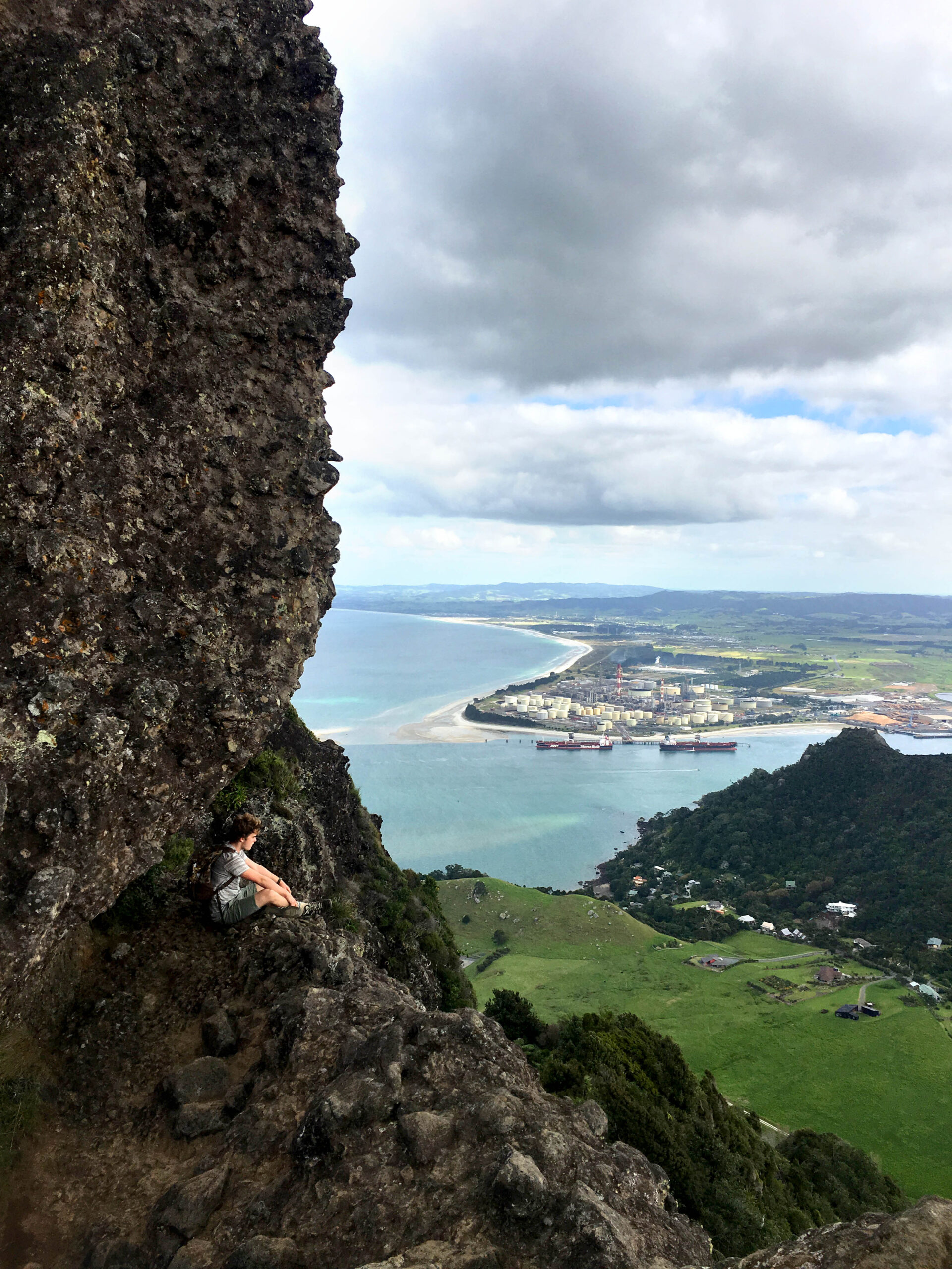
However, any calf burn is quickly rewarded with increasingly impressive vistas the higher you get. There are many places to stop to catch your breath and take in the scenery, one highlight being a rock plateau approximately three quarters of the way up. It provides panoramic views of the rest of the Whangarei Heads and Marsden Point, but caution is required as the end of the clearing has a sheer cliff face and vertical drop.
Mount Manaia has explosive origins. It is a remnant of a large stratovolcano which was likely to have been 1000m tall – twice the size Manaia is today – and part of a cluster of active volcanoes that dominated the top of the North Island millions of years ago. Manaia today is a result of its erosion over these millions of years, sculpted by flowing streams and changing coastline.
Māori history takes the mountain’s tallest craggy peak to represent Manaia, an ancestor and connector of Northland tribes, while the smaller peaks are his wife and children. Some traditions say that Manaia’s wife was unfaithful with Paeko, a servant. As a result, Manaia and Paeko exchanged incantations, during which Manaia and his family were turned to stone.
DOC has recently made improvements to the track surface (a mix of wide gravel path and wooden steps) so the walk can be taken year-round, but it’s best to choose a clear day to take advantage of the views. If it has been raining, be careful of slipperiness underfoot and always bring a jacket; even in sunny weather, at the summit the air can be surprisingly cool.
The regenerating native bush throughout the walk clears as you reach the summit, with a wooden staircase leading to the highest accessible point where you can enjoy vast, uninterrupted views that extend to the Whangarei Harbour to the west, Bream Bay and the Hauraki Gulf to the South, and the Poor Knights Islands to the north.
It took my friend and I, at a steady pace, only an hour (40 minutes up, 20 minutes down) to complete the walk. However to accommodate stops and a leisurely pace, allow around 2-3 hours.
If you’re looking to make a weekend of walking, the Bream Head Coast Walks Lodge (coastwalks.nz/accommodation) is a great place to stop for a night or two. Set in its own private bush setting with sea views, it has an outdoor, open air bath to give your tired legs a much-deserved soak. The friendly owners have a wealth of knowledge and are available to drop you off and pick you up at the end of your walk.